
Redwood National Park


Redwood National Park
The campground I had located in Grants Pass conveniently lay about equal distance from both Crater Lake and Redwood National Forest and I considered myself fortunate to have made it. The smoke had gotten worse since my arrival as the blazes continued to keep firefighters in action waging battle against nearly fifty conflagrations state-wide. A five acre spark up flared in my wake from the Gorge and shut down the Interstate mere hours after I passed through. Crater Lake was closed by a cluster of fires described as the High Cascades Complex and the Indian and Eagle Creek fires shut down Highway 84 in the Gorge and were quickly encroaching upon Multnomah Falls and Crown Point. The aforementioned near-misses and subsequent road closures along my just-traveled routes led to some concern about the accessibility of Redwood. The Chetco Bar blaze threatened Brookings just to the North of my intended route and had already scorched almost two-hundred thousand acres of Oregon woodlands. The fire was now left unfettered by the efforts of man and left to the winds and trees to determine a natural course. The smoke was thick and unpleasant as it hung in the cab. After several hours of driving, I began to feel light headed, particularly when stopped on inclines. The repeated sensation of rolling backwards caused me to apply unneeded pressure to the breaks as I waited for lights and road construction stops. I began to think the day was fueled more by obligatory notions of achievement over than those of curious exploration.
I set out on Highway 199 towards Crescent City and was on the infamous coastal 101 in little time. Aside from the smog, no further impediment was offered by the nearby infernos. I skirted down the coast towards the park and imagined what the view might look like on a clear day. Today, the horizon line was non-existent. Only a thick gray haze for as far as the eye could see which was only a few hundred feet at best. I hit the one-hundred and thirty-nine thousand acre park boundary as I crossed into California and took in the first few clusters of Redwoods near the Rouge River. They are massive trees, indeed. The Coast Redwood is the tallest tree on Earth and the current reigning Sequoia is “Hyperion” reaching just over three-hundred-seventy-nine feet high. The wood is easy to split and makes for a highly effective building material. It was first used by numerous known indigenous tribes for centuries prior to the influx of failed-miners-turned-loggers that decimated the original two million acres of rainforest before conservation efforts led to the protection of the remaining ten percent.
The area bore a striking resemblance to the Olympic Peninsula in Washington. The land was a lush green with trees, mosses and ferns. Douglas-fir and Sitka spruce sprung up amongst the Redwood. Even the trees themselves were rich ecosystems teaming with life in soils that collect on the massive branches. Around 45 species of mammals have been identified in the region ranging from the northern flying squirrel to the once-endangered Roosevelt Elk. Over four hundred bird species have been identified and the park host hundreds of invasive species introduced over the years. Like Olympic, Redwood park includes both rainforest and an expansive stretch along the Pacific Ocean that hosts a long list of fish and coastal wildlife.
I cruised through the Siskiyou National Forest region of the park as I admired the first few wooden giants. At some point I passed one of the three Visitor Centers within the parks extensive boundaries but I never saw it. Redwood was not like most of the other parks I had been to and lacked the National Park feel as it had no evident entrances or controlled access. Word is, the visitor centers are in dire need of improvement. I also witnessed more litter and trash along the road, trails and beach than any other place I have explored in the country. Not one trail I ventured down was free of discarded toilet paper and litter. “Leave No Trace” did not seem to apply to California and I had no idea the State motto “Eureka”, might be in response to the discovery of some indiscrete hippie’s movement. I had always romanticized the most Western State. Perhaps, I simply bought into in the common American theme of striking West to “The Golden State” and seeking fortune. Maybe, it was the just the ensuing illusion of a Hollywood fog. In either case, when one considers the number of working hands and the amount of wealth in the State, some basic minimum standards, and manners, would seem achievable. Several of the biggest directors in movie history have used the area as a film set. For the hundreds of millions generated in these cinematic endeavors alone, I would think a greater contribution to conservation and park infrastructure could have been negotiated. What of the State, Federal and fee funding in the most populated State in the Nation? I would have expected a greater sense of State and Park pride to be evident by a greater lack of…uh…evidence on the trail, although this is primarily the responsibility of park users. But what is different here over other parks? Apparently, a bigger tree to hide behind if not an area specific culture. I would advise California to take a lesson from Montana on trail maintenance and park preservation. We can greatly enrich our lives and communities with a natural and true outdoor experience. Nature has performed most of the heavy lifting in providing us an utterly spectacular planetary attraction. All mankind must do is simply care and not crap on it…literally. Everything we need to develop our trail systems is usually right there on the trail, just add determination and sweat equity while practicing “Leave No Trace”.
Supposed lack of funding also contributes to a very poorly developed series of logging roadways through the park. Many of these heavily trafficked roadways do not meet current safety guidelines and can be quite treacherous as I soon learned. I had gathered sufficient shots of the Redwoods along the Newton B Drury Parkway to satisfy my needs for trees and sought to reach the coast. I was elated to discover that the nearest beach was also frequented by the once endangered Roosevelt Elk. I headed for Davison Road, that according to Goggle Maps, would drop me right in front of the ocean on Gold Bluffs Beach. After the first of six miles, the road turned into an unpaved, ungraded, one-lane dirt trail. While I am comfortable hauling ass down such quasi-roadways, the traffic was incredible for such a narrow path. There was sufficient room for one vehicle with alternating sections of shoulder that two vehicles could just squeeze past in opposing directions. It created a consistent S shape as it wound down a thousand feet to the beach below. As opposing traffic was encountered, one of the vehicles would be forced to the edge of the shoulder and stop as the opposing vehicle eked by. The tight road, shoulder drop off and frequent blind turns amongst the huge trees was bad enough. Add a surprising amount of traffic, a dangerous amount of speed and unreasonable driver impatience and I found the route thrill-seeking worthy. It reminded me of riding in the taxis in rural Thailand. The farmers would lay out rice covering a hundred or so foot stretch of road completely covering one lane to husk the rice. These would alternate lanes for miles. The taxi drivers would shift lanes back and forth dodging the rice. I recall seeing a cab to the front approaching from the other direction and performing the same maneuver. Each taxi shot back and forth between lanes at speed dodging the rice as they approached one another. It was like an intense game of chicken as it was impossible to tell who was going to go in which direction as we got dangerously close to impact. At the last second, the opposing cab jerked into the free lane and turfed a long stretch of rice. It was a fascinating, albeit hair-raising, exchange of understanding between the taxis and the farmers. There was no such understanding here. These folks were in a hurry and six to seven cars would stack in one direction forcing a standstill as no one could maneuver beyond the deep trenched shoulders to the side when opposing traffic was encountered in both directions. No one seemed willing to alternate and not tailgate thus causing repeated stops as we inched by one another. Due to all the mentioned factors, the six-miles took about forty-five minutes to navigate but at long last, I was walking towards the sounds of the Pacific.
The sounds of the crashing waves were clear while the horizon was not. A distinct line was not evident in the haze. Just a grey backdrop emitting crests and troughs of turbulent water onto the dark sands. The sand was not like any other sand I have experienced on a beach. It was a thick, dry and granular mix. You could pick up a handful and grind it into your hands and it would pour out without leaving a grain behind. Gulf Coast sand sticks to everything. A short walk on the Gulf with wet feet and my legs could easily sand wood with the residual grit and I will be picking grains out my clothes for weeks after my trip. Not this sand. I lay in the grit and made sand angels without a grain sticking to me or my clothes. I marveled at its texture as I sat and took in the peaceful sounds while doodling in the dirt. I did not encounter any Elk until after braving the pass again and was back onto the paved portion of Davison Road. A large herd of visitors had gathered a few hundred yards away and were snapping shots of a smaller herd of Elk reposing in a field. I found the people’s behavior far more fascinating than the peaceful Elk as they clamored for selfies and iPhone shots that, at such a distance, were unlikely to yield much of a dynamic memory. As much as I wanted to stop and have a glimpse myself, crowds crash my outdoor experience in general and I was anxious to return to Grants Pass and start moving further South as I got word Crater had flared up again.
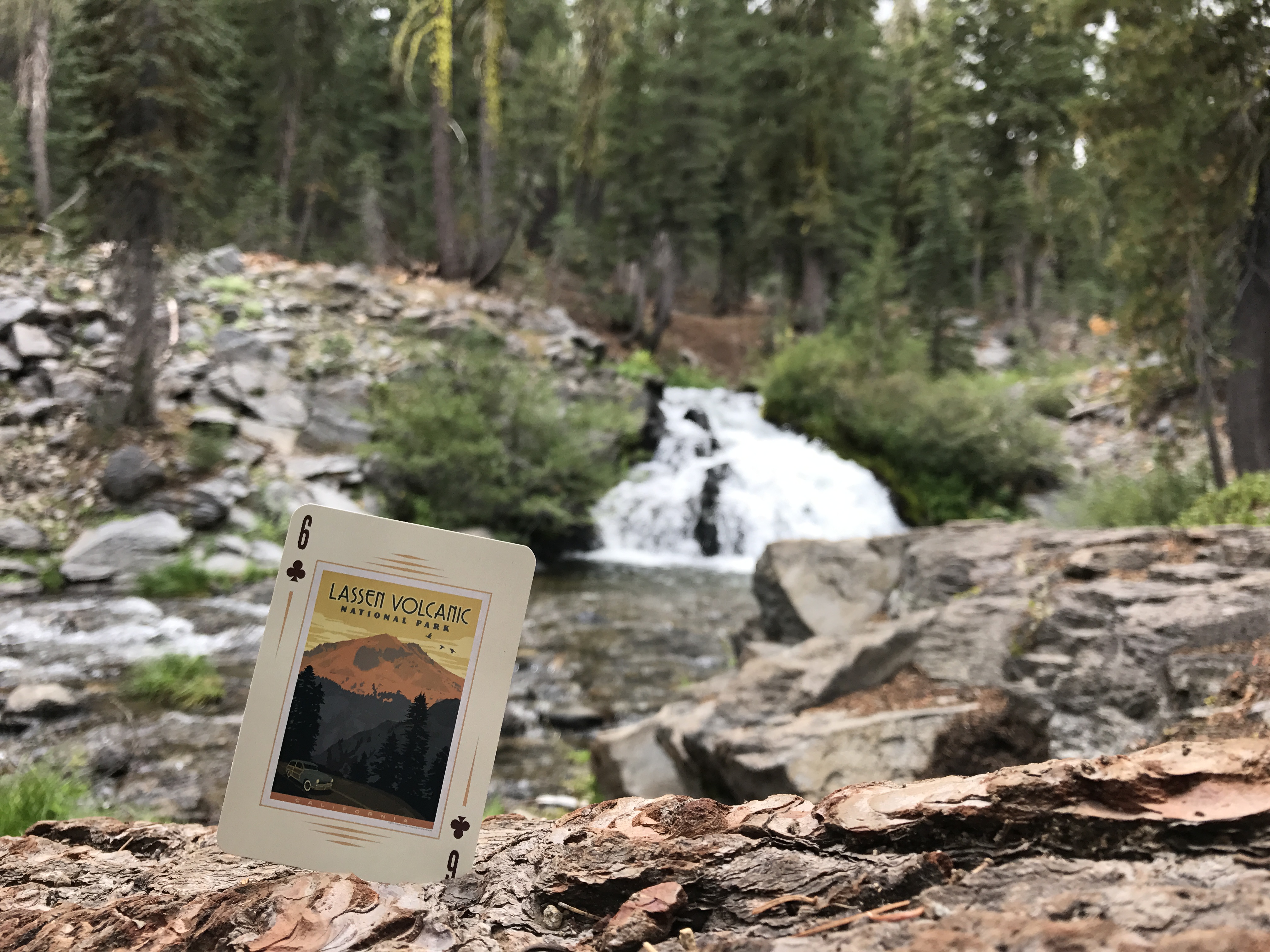
I made it back to the site without issue and prepped the rig to move South and East towards Lassen Volcano National Park. I was glad that I motivated myself to make the two-hundred and fifty-mile trek to Redwood. I considered that I only took in the Northern most section of a park that spans down 101 for miles and missed some of the most well-known highlights. I also considered that the smoky conditions played a role in degrading what might otherwise be visually appealing. It was, however, a bit what I expected: Trees. And while I do love the forest, the traffic and the trash crashes the overall outdoor experience. Redwood could do better.
Getting the Ruck out of here…
Note: At the time this entry was drafted on October 2nd, the Chetco Bar blaze was still raging and had finally moved into the Rouge River-Siskiyou region and took out a portion of the Redwoods that I explored. It began burning in early July. That’s a long time for a fire to rage out of control. I extend my gratitude, thanks and admiration to those risking safety while rendering service and share the loss of the affected communities.
Anna Broesche
These are spectacular stories….! I am sad to read the blaze continues….
Pamela Rhodes
Gotta admit….I was hoping to see a sand angel amongst your pix 🙂