Crater Lake National Park
Crater Lake National Park
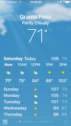
I departed from the Columbia River Gorge a second time. I had grown fond of my campground at Crown Point. I was going to miss being near so many friendly, and now familiar, faces but I needed to start heading South. It was already September and as any worthy GOT fanatic might say: Winter was coming…and with it, the snows. In fact, temperatures in Grants Pass, Oregon were expected to be near one-hundred-and-seven degrees Fahrenheit on September 5th, shattering prior almanac records. Clearly, I must have needed some heat under my wheels with the impending non-blizzards at my heels. Crater Lake saw fit to further encourage a delayed onset of cooler temps with a few hundred thousand acres of wildfires in the area to keep things warm and snuggly during those upcoming chilly nights that seem to be much more than a mere few months away.
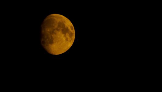
To exacerbate matters, smoke formed a brown haze that blanketed the Park and surrounding areas. Smoke could be seen from as far as Larch Mountain in the Gorge and once in the belly of the burning areas, one couldn’t see much at all. Not unlike the disappearing act of Mount Hood mentioned in ApocEclipse 2017, I had no idea what lay behind the smog. I could make out several layers of ridgelines two to three deep by the tonal quality of the haze. Anything lying beyond that immediacy, was lost to the smoke. It was an eerie effect and turned both, the Sun and Moon, into glowing orange orbs hanging in the brown haze. I had not cleared Interstate 5 by a few hours before the blaze shut it down in my wake. Talk about good timing. It was only days later that Teresa, Erin and the other residents of Crown Point (See ApocEclipse) were notified of their evacuation order.
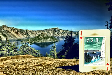
The drive into the Park on the route to the twenty-square-mile lake was surreal. Smoke filled the narrow slit of space the road created between the tall trees. My eyes burned in the acrid air and the smell of smolder and burnt cedar hung in the motionless and stifling atmosphere. I was certain that the views of Crater Lake would be rather poor under the current conditions. The National Park Service had reported less than optimal conditions as well. I had thought that at best, I might capture a shot not otherwise afforded in the absence of the numerous blazes in the vicinity. Most of the park was closed but the area that remained open just Happened to be the perspective I had hoped to achieve and matched that of the Anderson Design Group Crater NP card. To further my amazement, the smoke began to clear as I drove up the incline into the caldera of what once was Mount Mazama. Temperatures dropped to a tolerable degree and the two-thousand-foot caldera was completely free of smoke. Wizard Island and the Phantom Ship cinder cone features were clearly visible. The depths of cobalt blue water were still as glass and mirrored the sky, inviting my eye to feast on the stimulating imagery. The lake has no tributaries and refills itself through rain, snowmelt and the evaporative process and completely recycles its capacity of five trillion gallons every two-hundred and fifty years. Crater has some of the cleanest water in the world and at an average of nineteen hundred feet of depth, is the deepest lake in the Nation. Originally known as Giiwas to the indigenous Klamath, The lake was not always one of the world’s most unique and deepest bodies of water and no meteor formed the crater as many mistakenly assume. Some seven-thousand and seven-hundred years ago, Mount Mazama stood in its stead, emptying molten material from an enormous magna-chamber below until collapsing upon itself, the crown of Mazama dropping into the emptied cavity formed from the vented lava flow. Add a few thousand years of rain and snowmelt and a World Wonder is born.
While the lake is not fed by any rivers or streams, fish still found a way to populate the pristine aquarium, just not from natural sources. Man stocked the lake for around sixty years until around the 1940s and several species still flourish although several invasive species, including the crayfish, threaten the stability and are ongoing concerns. No human fishers could be seen on my day of exploration however I spotted a bald eagle far below my overlook scanning the blue water for prey. The majestic predator skimmed above the water surface affording a few quick snaps of my shutter.
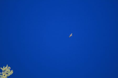
The deep blue color is not sky…it is the waters of Crater Lake below the eagle, as shot from above. This perceptual inversion may have contributed to numerous mysterious aircraft crashes in Crater’s documented history.
I explored along the caldera’s southern edge seeking any accessible vantage points for photos and took in the peaceful scene. It is difficult to imagine what it may have been like to have borne witness to the violent collapse. Geologic evidence, including ash covered footwear, supports the possibility that mankind was indeed in the area at that time. It must have felt apocalyptic. It is unknown if the collapse of Mount Mazama was witnessed or if any life was claimed as a result of the formation event but both the crater and the lake have claimed many lives since. A few months before my arrival, a man in his early twenties perished as a popular outcropping gave way beneath him resulting in a fatal fall. I stood near the location of the event. No barriers were present and it was well-worn with foot prints giving me the impression that it was likely a popular perch for photographers and park explorers. The land has a history of giving way and little could foresee such an event occurring with any accuracy. It was a case of very bad timing and very bad luck. Prior to the most recent tragedy, there a long list of unlucky individuals and groups that have perished in the area in a vast array of misfortune. The feature acts as a mausoleum in itself as not all of those that have perished have been recovered and are said to remain within the bowels of lake in quite repose. (Chronology of Fatal Occurrence)
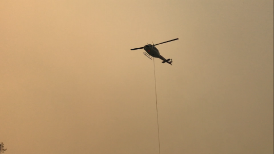
Airborne firefighters hot on the job
As I made my way back down the caldera, smoke began to fill the truck cab again and the skies darkened to a brown and gray tint. It was clear the valley opposing the crater was still in peril of succumbing to nearby blazes. Next to the road through the park, a helicopter hovered over a large container as it filled a lister bag for an airborne delivery of much needed water. I paid little attention to the sign at the entranceway of the park on my way out. Several hours later, after I had completed my work and settled in for the night I spotted a report and photo of the sign ablaze as firefighters fought to stymie the destruction. To say the timing of my departure was perfect would be an understatement.
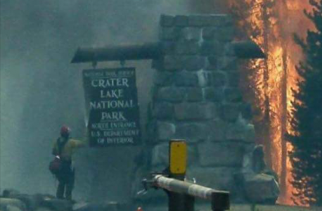
Photo Credit: Mark Baptista
Ruck on…
